RTK Survey · Site Intelligence
Drone Land Surveys and Site Intelligence
Designing a site on inaccurate ground data means costly redesigns later. We deliver engineering-grade aerial surveys with centimetre-level accuracy, ready to drop straight into your CAD or GIS workflow.
- EASA-authorised across all 27 EU member states
- IEC TS 62446-3:2017
- DCAC-registered
- Fully insured
What you get
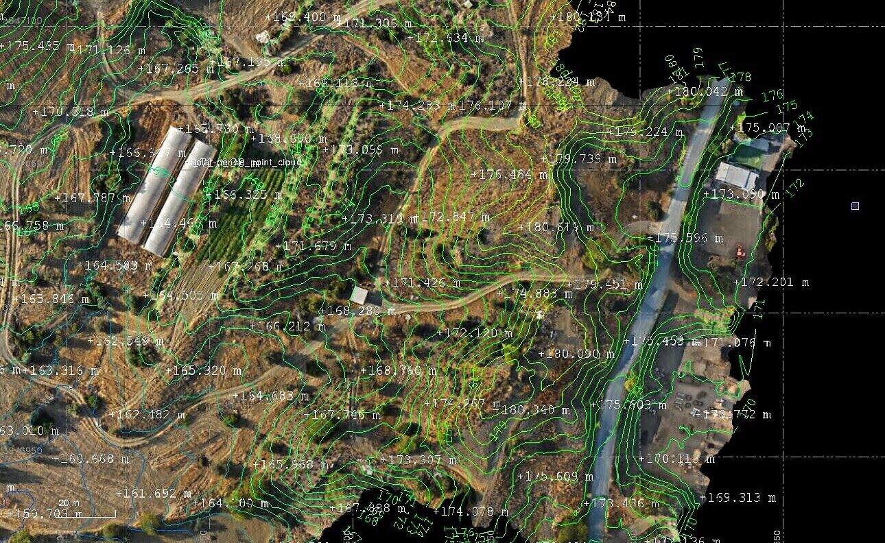
- RTK/GNSS drone mapping with centimetre-level accuracy
- Georeferenced orthomosaic of the full site
- Slope, contour, and cut-and-fill analysis
- Shading analysis and 3D terrain modelling
- CAD/GIS-ready outputs (DWG, DXF, GeoTIFF) in your coordinate system
What the output looks like
Real findings from real surveys.

Analysis and reporting delivered via leading inspection platforms.
Where it fits
Solar site development and permitting
Construction monitoring with progress orthomosaics and as-built verification
Surveyors who want an aerial partner that handles the flight, regulation, and processing
Around 75% faster than traditional ground survey, with seamless CAD/GIS integration.
Developer
Fast, accurate, and engineer-ready. We had CAD contours and spot heights, a high-resolution orthomosaic, and an interactive 3D model we could open right in the browser. It saved our team real time on early site assessment.
See exactly what the output looks like.
Book 20 minutes and we will walk you through a real land surveys report on a real site, so you can judge the quality before you commit to anything.